
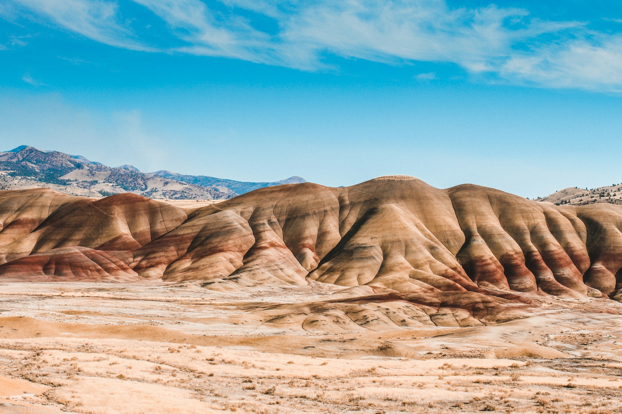
John Day Fossil Beds is three separate NPS units across east-central Oregon, not one tidy park loop. Painted Hills gets the famous stripes. Sheep Rock holds the visitor center and blue-green claystone. Clarno keeps the oldest rock and the only trails where fossils show in place. Together they protect more than 14,000 acres and a Cenozoic record from roughly 44 million to 7 million years ago. No dinosaurs. The story is mammals, plants, and climate change written in layered hills.
This guide is routing-first: one-day versus two-day plans with NPS drive times, viewpoints and short walks ranked by effort, practical notes on fees, heat, and no-service stretches, plus photography timing for Painted Hills color. Fees, visitor-center hours, and road conditions change. Confirm on the NPS John Day Fossil Beds site before you leave.
Building a wider Oregon loop? Use the Western US parks and road trips hub. Cascades snow against this dry-side geology pairs well after Crater Lake in the spring.
At a glance
| Item | Planning reality |
|---|---|
| Units | Painted Hills (near Mitchell), Sheep Rock (Hwy 19 between Dayville and Kimberly), Clarno (Hwy 218 west of Fossil) |
| Drive times (NPS) | Sheep Rock ↔ Painted Hills ~45 miles / 1 hour; Painted Hills ↔ Clarno ~75 miles / 1.5 hours; Clarno ↔ Sheep Rock ~81 miles / 2 hours |
| Road pace | Winding roads; NPS suggests averaging no more than ~45 mph; Hwy 218 toward Clarno often closer to ~35 mph |
| Entry fee | Free; no entrance pass required (verify before travel) |
| Outdoor access | Trails and overlooks open 24 hours in all three units |
| Visitor center | Thomas Condon Visitor Center at Sheep Rock; hours vary by day and holiday (verify) |
| Services | No lodging or restaurants inside the monument; limited gas in Mitchell, Dayville, Fossil, Spray |
| Cell | Little to none in the units; public wifi at the visitor center and Painted Hills Picnic Area per NPS |
One day or two: routing the three units
Mapping apps underestimate these drives. Build buffer. Fill the tank in town; rural stations often close overnight. NPS advises topping off before night travel after about 7 p.m. in summer or 6 p.m. in winter.
One-day plan (two units)
Best pairing: Painted Hills + Sheep Rock (~1 hour between them). Start early.
- Morning at Sheep Rock. Thomas Condon Visitor Center when open for exhibits and current conditions. Short overlook near the center if you want a warm-up. Then Foree or Blue Basin by heat and energy (see ranking below).
- Drive to Painted Hills. Use afternoon and late light for color.
- Short Painted Hills walks first (Overlook, Painted Cove, optional Leaf Hill or Red Scar Knoll). Add Carroll Rim only if it is still cool and knees feel cooperative.
Skip Clarno on a single day unless you are already passing Fossil. Adding it turns the day into mostly windshield time.
Alternate: Clarno alone if looping through Fossil, then overnight toward Mitchell or Dayville for Painted Hills next morning. Clarno’s trails are short; Hwy 218 is the tax.
Two-day plan (all three)
Day 1: Sheep Rock → overnight near Mitchell or Dayville → Painted Hills late day or next morning. Do Blue Basin when temperatures are kinder; save Painted Hills for evening color or first light.
Day 2: Clarno (~1.5 hours from Painted Hills per NPS), then toward Hwy 97, Bend, or the John Day valley.
Stripes only? Painted Hills plus Sheep Rock context is enough. Clarno rewards curiosity more than postcard hunting.
Best viewpoints and short walks (effort-ranked)
Stay on trail. The clay bruises easily; NPS’s “Don’t Hurt the Dirt” guidance is real. Walking on the painted slopes is prohibited. Distances below are NPS figures. Easiest first.
Easiest (viewpoints and under ~0.5 mile)
- Painted Hills Overlook Trail (0.5 mile roundtrip). Fairly level. The classic stripe view. Do this even if you skip everything else here.
- Painted Cove Trail (0.25 mile). Boardwalk close to red and gold clay.
- Leaf Hill and Red Scar Knoll (each ~0.25 mile). Easy add-ons with separate parking pulls.
- Mascall Formation Overlook (~430 feet) and Thomas Condon Overlook (~0.25 mile) at Sheep Rock. Quick context by the visitor center.
- Clarno short set: Trail of Fossils (0.25-mile loop), Clarno Arch (0.25 mile roundtrip), Geologic Time Trail (0.25 mile each way). Clarno is the only unit with fossils visible on trail. Look, photograph, leave them.
Moderate (still under ~1.5 miles)
- Foree, Sheep Rock: Flood of Fire (~0.4 mile) and Story in Stone (~0.3 mile). Canyon color without Blue Basin mileage.
- Cant Ranch / Sheep Rock Overlook (~0.5 mile) and River Trail (~0.6 mile). Historic district plus river flats.
- Island in Time, Blue Basin (1.3 miles roundtrip). Green claystone without the full overlook loop.
Harder (cooler hours only)
- Carroll Rim, Painted Hills (1.6 miles roundtrip, ~400 feet gain). Ridge panorama. Strong in a cool morning; rough in midday summer heat.
- Blue Basin Overlook loop (3.25 miles). Longest common day hike here. Spring, fall, or an early summer start with extra water.
The three units, briefly
Painted Hills sits about 9 miles northwest of Mitchell via Burnt Ranch Road and Bear Creek Road. Red, gold, black, and tan bands mark old soils from wetter forests to drier grasslands. RVs and large trailers should park at the Overlook lot; NPS does not recommend them past that point. Overlook + Painted Cove covers the visual payoff when time is short.
Sheep Rock (32651 Highway 19, Kimberly) sits between Dayville and Kimberly along the John Day River. Blue-green cliffs, the Thomas Condon Visitor Center, and Cant Ranch Historic District. Outdoor ranch grounds stay open even when house-museum hours are limited. Island in Time for a shorter canyon feel; full Blue Basin Overlook only if heat and mileage still feel friendly.
Clarno is on Hwy 218 about 20 miles west of Fossil. Oldest exposed layers in the monument. The Palisades are volcanic mudflow cliffs; fossil leaves and wood appear along the short trails. Budget time for the curvy approach, not for long hiking.
When to go
Outdoor areas are open year-round. Weather decides quality.
- Spring (about April to June): Milder highs, wildflowers in good years, clearer hiking windows.
- Summer: Hot and dry; afternoons often past 90°F. Front-load walks. Shade is scarce on clay trails.
- Autumn: Cooler air, thinner crowds, strong light for photos.
- Winter: Quiet. Occasional snow can sharpen hill color. Watch ice on approaches.
After rain, Painted Hills colors deepen. Trails turn muddy and fragile; stay on designated paths.
Fees, hours, services, lodging
Fees. Entry is free; no pass required at this writing. Recheck NPS fees. Other parks on the same trip may charge.
Hours. Trails and overlooks open at all times. Confirm Thomas Condon Visitor Center days, times, and holiday closures on NPS hours. Cant Ranch house hours depend on staffing.
No-services stretches. Nothing to eat or sleep inside the monument. Cell drops out in the units. Download maps offline. Carry water, snacks, and sun protection for the Mitchell–Dayville/Kimberly–Fossil triangle.
Gas. Mitchell, Dayville, Spray, Fossil. Do not assume late-night pumps.
Lodging towns (outside the monument). Mitchell for Painted Hills; Dayville for Sheep Rock proximity; John Day for more motel and restaurant choice; Fossil if Clarno is your anchor. Camping exists in the region, not inside the units. Book ahead on summer weekends.
Drive ballparks. Portland to Painted Hills often ~4.5 hours; Bend roughly 2 hours to that area; John Day town to Sheep Rock ~1.5 hours. Your exact route will move those numbers.
Photography timing for Painted Hills
Color here is angle and moisture more than slogans.
Morning. Soft light, cooler walking, fewer people on Overlook and Painted Cove. Cleaner bands with gentler shadow.
Late afternoon to evening. Side light deepens reds and golds. Arrive with time to walk Overlook slowly, then Painted Cove, not a sunset sprint only.
After rain. Saturated clay looks richer and damages easily. Stay on trail; do not step onto the hills for a better angle.
Midday. Flat for photos, hard on bodies. Fine for the visitor-center drive. Poor for Carroll Rim in July.
Sheep Rock’s Blue Basin often looks cleaner earlier, when light reaches the green claystone. Clarno needs close looking on the fossil trail more than dramatic sky.
Pack short list
More water than “short walks” suggest. Hat, sunscreen, sunglasses. Closed-toe shoes with tread. Snacks. Offline map. Wind layer for Carroll Rim or Blue Basin. Leave fossils where they are; collecting is illegal.
Oregon loop stitches
Eastbound dry-side: Bend or Prineville → Painted Hills afternoon → overnight Mitchell or Dayville → Sheep Rock next morning → continue toward John Day or Baker City.
Cascades then fossils: Crater Lake → Highway 97 / 26 corridor → Painted Hills and Sheep Rock.
Full triangle: Two nights near Mitchell or Dayville; Clarno as day-two through-drive or out-and-back. The Western US parks hub helps place John Day on a longer Oregon map.
Bottom line
Treat John Day Fossil Beds as three small parks linked by slow roads. Prioritize Painted Hills overlooks and Sheep Rock context on a single day. Add Clarno on a second day or a Fossil-area route. Rank walks by heat and effort, verify visitor-center hours, and carry water like summer means it. The stripes are famous for a reason. The fossils and the quiet are why the drive is worth planning carefully.
FAQs
Is it free? Yes at this writing. No entrance fee or pass. Verify on NPS before you go.
All three units in one day? Possible with a very early start, per NPS, but driving dominates. Painted Hills + Sheep Rock is the sane one-day combo.
Where to stay? Mitchell, Dayville, John Day, or Fossil depending on which unit you anchor. No lodging inside the monument.
Are the trails hard? Most signature stops are under a mile. Carroll Rim (~1.6 miles, ~400 feet gain) and Blue Basin Overlook (3.25 miles) are the main effort jumps. Heat makes every trail feel harder.
Best Painted Hills color? Side light in morning or late afternoon, and after rain when clay is damp. Midday summer is weakest for photos and comfort.
