
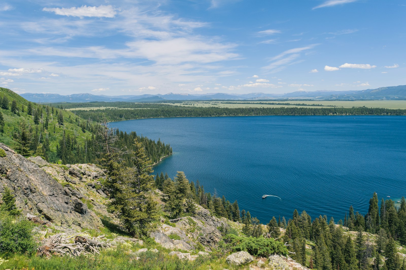
Bighorn Canyon National Recreation Area straddles the Montana and Wyoming border, with a 71-mile lake winding between canyon walls up to about 1,000 feet high at Devil Canyon. It has wild horses, bighorn sheep, historic ranches and dark skies, and it sees a tiny fraction of the crowds that Yellowstone gets. It is also free to enter. The catch is that the park is split into two districts with no road between them inside the park, so planning matters more here than at most parks.
This is the big-picture guide: how the two districts work, what to see in each, trails, camping, wildlife and practical details checked against National Park Service pages in October 2026. If you mainly want to get out on the lake from the Montana side, my Bighorn Canyon pontoon boat rental guide covers Ok-A-Beh in detail. For more route ideas, see my Western US parks and road trips hub.
Bighorn Canyon at a Glance
| Item | Details (checked October 2026) |
|---|---|
| Entrance fee | Free; NPS suspended the fee program in 2018 |
| Hours | Open 24 hours, year-round, except rare winter road closures |
| Districts | North (Fort Smith, MT) and South (Lovell, WY) |
| Drive between districts | About 3 hours; no connecting road inside the park |
| Visitor centers | Cal S. Taggart Visitor Center in Lovell (year-round); Yellowtail Dam Visitor Center (closed) |
| Marinas | Ok-A-Beh and Horseshoe Bend, both roughly Memorial Day to Labor Day |
| Nearest airports | Billings (about 1.5 hours to either district); Cody (about 1 hour to the South District) |
| Public transport | None |
Where Is Bighorn Canyon?
The recreation area was created in 1966 after the Bureau of Reclamation built Yellowtail Dam on the Bighorn River. The authorized boundary covers more than 120,000 acres, and Bighorn Lake stretches about 71 miles at full pool, roughly 55 miles of it inside the canyon itself. The dam is named for Robert Yellowtail, a Crow tribal chairman, and the North District sits beside the Crow Reservation.
North District (Fort Smith, Montana) is mostly about water: Ok-A-Beh Marina and boat launch, the Afterbay reservoir and campgrounds, and access to the famous Bighorn River trout water below the dam. From Billings it is about 95 miles via Hardin.
South District (Lovell, Wyoming) is mostly about land: the scenic drive on Highway 37, Devil Canyon Overlook, 12 hiking trails, four historic ranches, the Pryor Mountain Wild Horse Range and Horseshoe Bend Marina. From Billings it is about 90 miles; from Cody it is about 47 miles.
Pick one district if you only have a day. If you want both, budget at least two days and plan the three-hour drive between them.
South District Highlights
Bighorn Canyon Scenic Drive
Wyoming Highway 37 runs north from US 14A near Lovell through the South District to Barry’s Landing. It passes Horseshoe Bend, crosses the wild horse range, and reaches the overlooks.
- Devil Canyon Overlook: the classic view, with sheer walls dropping about 1,000 feet to the lake where Devil Canyon meets Bighorn Canyon. It is also a top spot for night skies.
- Horseshoe Bend: a marina, swim beach and campground near the southern end of the lake.
- Barry’s Landing: the end of the road, with a boat ramp and the nearby Trail Creek Campground.
Hiking
NPS lists about 17 miles of described trails, 15 trails parkwide, and 12 of them are in the South District. A few good options:
| Trail (South District) | Round trip | Difficulty |
|---|---|---|
| Sullivan’s Knob | 0.75 mi | Easy to moderate |
| State Line Trail | 1.52 mi | Easy to moderate |
| Mouth of the Canyon | 1.8 mi | Moderate |
| Lower Layout Creek | 3.4 mi | Easy to moderate |
| Barry’s Island | 4 mi | Moderate |
| Sykes Mountain | 4.6 mi | Hard |
Sullivan’s Knob is the short, big-payoff choice for a canyon view. Lower Layout Creek is a longer, gentle option, best in cooler months. This is dry, exposed country. NPS warns about rattlesnakes, ticks, poison ivy and unstable canyon rims, so carry plenty of water, wear closed-toe shoes and stay back from edges. Start early in summer; midday heat out here stacks nicely on top of any heat you are already generating on your own.
Pryor Mountain Wild Horse Range
The Bureau of Land Management (BLM) manages this range of roughly 38,000 to 39,000 acres, created in 1968 as one of the first designated wild horse ranges in the country. About a fifth of it lies within Bighorn Canyon NRA, and Highway 37 crosses part of it.
NPS says the best roadside spots for horses are near Crooked Creek and Mustang Flats, roughly between the Crooked Creek Contact Station and Ewing-Snell Ranch. BLM describes the herd as mixed ancestry with a measurable Colonial Spanish influence, including a rare gene variant traced to early Spanish horses, rather than pure Spanish mustangs. BLM estimated about 200 horses aged one and over in spring 2024. Give horses plenty of space, never feed them, and stay in your car if they are on the road.
Historic Ranches
Four historic ranches in the South District are open for self-guided visits: Mason-Lovell, Ewing-Snell, Lockhart, and Cedarvale (Hillsboro). Lockhart Ranch belonged to the writer Caroline Lockhart. Ewing-Snell now also serves as the Bighorn Canyon Research Center.
North District Highlights
Boating on Bighorn Lake
The north end of the lake is reached from Fort Smith at Ok-A-Beh, which has a launch ramp and a marina open roughly Memorial Day to Labor Day, with pontoon rentals. The full rental details, costs and sample plans are in my Ok-A-Beh pontoon guide, so here are the parkwide basics:
- Ramps: Ok-A-Beh in the north; Horseshoe Bend, Barry’s Landing and the Kane ramp in the south.
- Lake levels: levels swing widely, and each ramp and dock has a minimum operating elevation. NPS advises avoiding areas south of Horseshoe Bend and the South Narrows when the lake is below 3,625 feet. Check the NPS launch levels page before you go.
- Tours: Hidden Treasure Charters runs 2-hour boat tours from Horseshoe Bend, listed at 10 am and 2 pm daily in season. NPS also offers free ranger-guided kayak tours in both districts; ask a visitor center for dates.
- Bringing your own boat: Wyoming and Montana both require aquatic invasive species inspections. For non-residents, a Wyoming AIS decal is US$30 for motorized boats and US$15 for non-motorized boats in 2026; Montana’s Vessel AIS Prevention Pass is US$30 for motorized boats and US$10 for non-motorized boats. Stop at every open check station.
Fishing
The Bighorn River below the dam is one of the best-known trout rivers in the country, and the Afterbay is mainly rainbow trout. The lake holds walleye, trout, yellow perch, catfish and more. No park permit is needed, but you need a state license and must follow state rules, so know whether you are in Montana or Wyoming.
Yellowtail Dam
The dam stands 525 feet high. Note that NPS says the Yellowtail Dam Visitor Center is closed, and dam tours and access to the top of the dam have ended for security reasons.
Wildlife
NPS lists bighorn sheep, wild horses, mule deer, coyotes, mountain lions, bears and more than 200 bird species. The Yellowtail Wildlife Habitat Management Area near the south end of the lake is good for bald eagles, pelicans and white-tailed deer. Bring binoculars, and drive slowly on Highway 37 at dawn and dusk.
Camping
Much of the camping is first come, first served, with a small number of reservable South District sites through Horseshoe Bend Marina.
- Horseshoe Bend (South): the only campground with hookups, with utility and non-utility sites. Currently run by Hidden Treasure Charters under a pilot agreement, with fees paid at the on-site iron ranger.
- Trail Creek, near Barry’s Landing (South): non-utility sites, fees paid at the iron ranger.
- Medicine Creek (South): boat-in or a 3-mile hike from Barry’s Landing.
- Afterbay (North): near Fort Smith, convenient for river anglers.
- Black Canyon and other boat-in sites: reachable only by water; docks are removed in winter.
- Dispersed camping: free and with no permit, below the 3,640-foot high water mark in undeveloped areas. Pack out everything and check fire restrictions.
Best Time to Visit
- Late May to early September: marinas, tours and boat services operate. Expect summer highs often in the 80s and 90s F, with occasional afternoon thunderstorms.
- September and early October: cooler hiking, quieter roads and good light, though marinas close after Labor Day.
- Winter: the park stays open, but services shrink and US 14A over the Bighorn Mountains usually closes from late November to mid-May.
Visitor center hours change seasonally and can be affected by staffing, so check the NPS site before a long drive.
Getting There and Nearby Routes
Billings is the main gateway for both districts, and Cody works well for the South District. Services are thin, so fill up on fuel and groceries in Lovell, Hardin or Billings, and expect patchy cell coverage. My flashpacker travel logistics hub has tips for remote driving days like this.
From Lovell, US 14A climbs east into the Bighorn Mountains. NPS notes it is known as the Medicine Wheel Passage, and it passes the turnoff for the Bighorn Medicine Wheel, an easy pairing with the South District in summer. If you are building a longer Montana trip, my guide to things to do on Highway 2 in Montana covers the state’s northern Hi-Line route.
Suggested 3-Day Plan
- Day 1: Lovell visitor center, Highway 37, Sullivan’s Knob, the wild horse range and sunset or stargazing at Devil Canyon Overlook.
- Day 2: A morning boat tour or kayak from Horseshoe Bend, then the historic ranches. Optional evening detour up US 14A toward the Medicine Wheel.
- Day 3: Drive about 3 hours to Fort Smith for the lake from Ok-A-Beh or a day on the Bighorn River.
FAQs
Is there an entrance fee at Bighorn Canyon?
No. NPS suspended the fee program in 2018, and no entrance pass is required. Campground fees and boat rentals still apply.
Can you drive between the North and South Districts?
Not inside the park. The drive between Fort Smith and Lovell takes about three hours via outside highways.
Where is the best view in Bighorn Canyon?
Devil Canyon Overlook in the South District, about 15 miles up Highway 37 from the Lovell area.
Where can I see wild horses?
Along Highway 37 near Crooked Creek and Mustang Flats in the Pryor Mountain Wild Horse Range. Sightings are common but not guaranteed.
